
It is amazing how much is being kept out of the news these days. Hysterical reports of us all roasting to death make headlines constantly while a landslide in Washington that probably killed over 100 people makes near zero headlines with the Hopes for Washington mudslide survivors fade after more bodies are pulled from debris | Mail Online being the first to speculate that many died there. It is a strange feeling, seeing so-called news services failing to inform us about life and death issues while whining about computer projections based on erroneous assumptions making headlines and occupying the brains of our oligarch rulers who want desperately to tax our energy consumption.
The horror in Washington has made fewer headlines than tropical storms on the other side of the planet. If over 100 people died due to a typhoon is headlines, why isn’t Americans dying also important? Of course, the warnings issued by our rulers about us roasting to death talks mainly about fire and drought and rising oceans. As I predicted recently, waves of storms are passing over the West Coast causing blinding blizzards and rain which is causing landslides and avalanches. Here is the 48 hour projection for storms in the US:

Looks like even LA will have rain and the drought so wanted by the global warmists is ending.
The landslide in Washington isn’t a shock, I looked at the geology of the landscape from before the collapse of the mountainside and it is clearly sliding slowly two years before it rushed downwards:

I scanned the surrounding landscape and didn’t spot other sites like this one. Geologists should have noticed this in the past, it wasn’t hard to spot. I live on a mountain and I worry about landslides but my place seems geologically secure…so far.

This last two weeks, the entire coastline of North and South America has been extremely geologically active with many earthquakes. The pressure on the San Andreas where it is locked in California is immense and definitely the jump northwards of much of the west coast in California is impending. These earthquakes help disturb already unstable mountainous geological features.
That, plus the heavy rain that is now wrecking the ideology of the warmists, is causing mayhem. Landslides and Engineering Geology of the Seattle, Washington, Area – Google Books

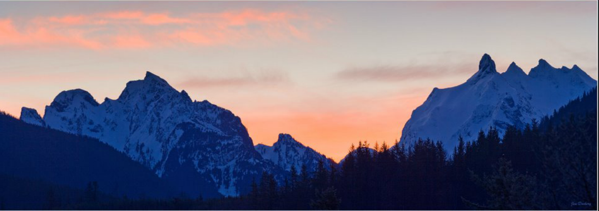
Below is a photo of the steep, concave shaped mountainsides at the bend of the North Fork of the Stillaguamish River where the landslides happened:

These mountains happen to be exactly where the Great North American glaciers ended, their terminus point on the West Coast. HistoryLink.org- the Free Online Encyclopedia of Washington State History: Puget Sound which this is part of, was basically created only 15,000 years ago which is yesterday in geological time.
What I find rather scary is the geological explanation at the Washington State History site assumes the Ice Ages have ended forever. As if we are not in an ‘interglacial’ but rather, the climate we enjoy today is ‘normal’ and thus, is expected to continue forever.

 Email:
emeinel@fairpoint.net
MAILING ADDRESS:
EMS NEWS
P.O. BOX 483
BERLIN, NY 12022
Make checks out to ‘Elaine Supkis’
Click on the Pegasus icon on the right sidebar to donate via Paypal.


Dave Petley’s “Landslide Blog” has been posting about this and also refers to some great posts from Dan McShane’s “Reading the Washington Landscape” blog which covers the geology and history of the slide area.
It is well known longtime historic landslide by forestry and geology experts and even had Army Corps of Engineers working to stabilize the toe after a previous slip redirected the river channel significantly. So comments by politicians today that this came out of nowhere are completely disingenuous. There’s many ways this could have been monitored and remediated with no casualties. I have slope stability work background and this is obvious to all of us who have, even though no one is accusing anyone yet out of respect for the ongoing recovery work.
McShane’s posts have good historic airphoto and LIDAR imagery of the evolution of this slide area with geology explanations but you have to read back over several posts them to get it all.
Note that this landslide is known by several names: Steelhead, Oso and Hazel, to avoid confusion.
Dave Petley’s Landslide Blog:
http://blogs.agu.org/landslideblog/
Dan McShane’s Reading the Washington Landscape Blog:
http://washingtonlandscape.blogspot.ca/
Also, in Google Earth you can choose from several historic airphoto mosaics dating back to 1989 and compare. Dan McShane does that for you as well in his posts.
I should add that it may have been somewhat unexpected that the rotational failure at the slide headwall and toe transferred force to the river sediments causing liquifaction.
This is where water pore pressure between soil grains overcomes the cohesive friction of those particles and the soil becomes like a liquid. You can get the same effect if you go out on a sandy beach near the waters edge and jump up and down on the sand. Water starts to collect and squirt from the sand and the sand gets jiggly and soft. Your jumping is like the force of the slide toe hitting the saturated river sediments.
This is a somewhat rarer consequence of rotational failures in river areas but not unknown. It requires a higher water table in the river sediments than usual as well as the right amount of force to generate the liquifaction.
This liquifaction is the cause of the bulk of the fatalities, not the rotational failure which would have been limited to the toe of the slope and perhaps a portion of Steelhead Drive.
As rare as it may be, while I worked in the BC Gov some years ago we had a river sediment liquifaction failure like this at a coal mine which blocked a large river for several days so I’ve seen this before. Happily there were no casualties in that case- there were drillers near the headwall of the rotational failure that ended up on the initial slide surface but they were above the liquified area.
Image showing extent of liquifaction from Petley’s post:
http://goo.gl/Vw0iCr
Petley post discussing the liquifaction:
http://goo.gl/cGO8dM
Thanks for raising awareness of this disaster. If people want to help out, I’ve posted some links at http://wildninjablog.com/2014/03/25/oso-aid/. Thank you!
Thank you for all the information about the geology, Jimmy. Much appreciated. I did only a small satellite searched and could see clearly the impending disaster and didn’t know that this was foreseen by geologists.
My husband used to work for the NY State Geological Survey and we both have a bit of geology skills. I think geologists are an interesting group, they specialize in disasters, of course.
Volcanoes, earthquakes, tectonic plate movements, meteor strikes, so on: one disaster after another! And they run towards the dangers.
Volcanoes, earthquakes, tectonic plate movements, meteor strikes, so on: one disaster after another! And they run towards the dangers.
And relative to the amount of ‘press’ AGW gets to those dangers….????